Malls · Georgia
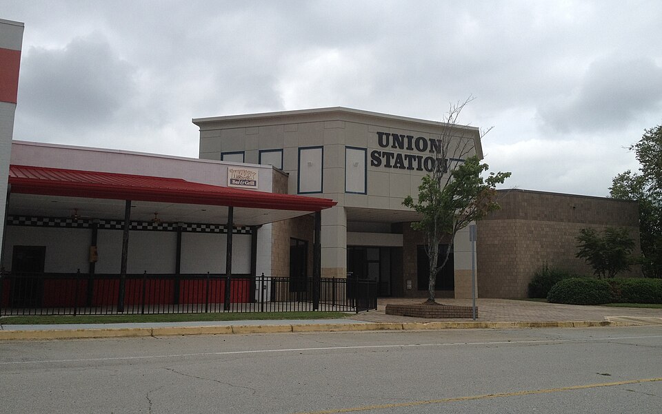
Union Station
Union Station Mall opened 1980, declined due to regional competition, closed 2010, demolished 2014 for Atlanta Metro Studios redevelopment ongoing. · summary, model-written
Solid = from the authors' map · outlined = public source · dashed = model-written, not yet reviewed by a person. Tap any value's source label to see where it came from. documented = a quoted excerpt (click to read it) · reported = a source named, no excerpt yet · no source.
Site profile9 elements · what this retrofit is built with · tap a chip for the evidence
Public body
This site: DEVELOPMENT AUTHORITY OF FULTON COUNTY county-parcels · all sites with thisSingle-purpose entity
This site: DEVELOPMENT AUTHORITY OF FULTON COUNTY OR CPUS UNION STATION LP county-parcels · all sites with this30,000+ vehicles a day on an adjacent road
This site: 155,000 on 85 fhwa-hpms · all sites with thisCounty permitting 2,000+ apartment units a year
This site: 8,159 units, Fulton County census-bps · all sites with thisGrocery within 800 m
This site: 5 stores openstreetmap · all sites with thisInterstate or freeway within 600 m
This site: 85 fhwa-hpms · all sites with thisLower-income tract (< $50k)
This site: $38,196 census-acs · all sites with thisRenter-majority tract
This site: 79% census-acs · all sites with thisBuilding footprint 50,000+ m²
This site: 91,815 m² overture · all sites with thisNow
| Status | Status not verifiedWikidata reported |
|---|---|
| Owner of record | Development Authority Of Fulton County Or Cpus Union Station LPcounty assessor reported |
Parcels, tax and title
| Parcel | Owner of record | Acres | Use · zoning | Value (appraised · assessed · taxable) | Last sale · deed | ||||||||||||||||||||||||||||||||||||||||||||
|---|---|---|---|---|---|---|---|---|---|---|---|---|---|---|---|---|---|---|---|---|---|---|---|---|---|---|---|---|---|---|---|---|---|---|---|---|---|---|---|---|---|---|---|---|---|---|---|---|---|
09F150800620344all 26 county fields
| Development Authority Of Fulton County Or Cpus Union Station LP PO BOX 638, ADDISON TX 75001 | 59.9 | 888 | $53.9M (appraised) assessed $19.4M | — | ||||||||||||||||||||||||||||||||||||||||||||
09F150800620351all 26 county fields
| Development Authority Of Fulton County 445 BISHOP ST STE 200, ATLANTA GA 30318 | 20.9 | 888 | $25.3M (appraised) assessed $9.1M | — | ||||||||||||||||||||||||||||||||||||||||||||
| Total | 80.8 | $79.2M |
Securitised debt and public filers
Filings (2001 to date) that name “Union Station” and “Union City” (63 hits, first 63 sampled, 3 other filers such as tenants left out). Only weak matches to commercial-mortgage trusts: the mall may have backed a securitised loan, or may just be mentioned in the filing; several trusts usually means one loan split into pari-passu notes. Earliest trust filing in the sample 2004-01-07 (a sample date, not the issuance date); candidate loan vintage 2004 from the trust name (weak match). Whether the loan is still in the pool, in special servicing or repaid is in the trust's monthly distribution reports, which are not searchable here. Text matches, not a title search. Open the search · all trusts.
| Kind | Filer | Filings | Dates | Forms |
|---|---|---|---|---|
| CMBS trust (weak) | Credit Suisse Commercial Mortgage Trust Series 2007-C5 | 2 | 2007-11-27 to 2007-11-27 | 8-K 2 |
| CMBS trust (weak) | GE COMMERCIAL MORT CORP PASS THR CERTS SER 2004-C1 | 1 | 2004-01-07 to 2004-01-07 | 8-K 1 |
| Public owner (weak) | EQUITY RESIDENTIAL (EQR) | 35 | 2005-03-14 to 2026-02-13 | 10-K 21, 8-K 14 |
| Public owner (weak) | ERP OPERATING LTD PARTNERSHIP | 33 | 2005-03-14 to 2026-02-13 | 10-K 21, 8-K 12 |
| Public owner (weak) | CATELLUS DEVELOPMENT CORP | 4 | 2001-03-21 to 2003-08-11 | 10-K 3, 10-K/A 1 |
| Public owner (weak) | CATELLUS DEVELOPMENT CORP | 2 | 2004-03-12 to 2005-03-04 | 10-K 2 |
| Public owner (weak) | GRAMERCY CAPITAL CORP | 1 | 2010-03-17 to 2010-03-17 | 10-K 1 |
Site context
| FEMA flood zone | X · AREA OF MINIMAL FLOOD HAZARDFEMA NFHL |
|---|---|
| EPA-regulated facilities within 500 m | 2: JIFFY LUBE STORE #1634; OAKLEY TOWNHOMES - 18EPA FRS |
| Census tract 13121010525 | 2,658 people, 3,192 per sq mi; median household income $38,196; median gross rent $1,316; 79% renters; 4.8% vacant units; 11.0% commute by transitACS 2023 5-year |
| Within a 10–15 minute walk (800 m) | 4 of 6 daily needs: 5 grocers, 0 schools, 0 parks or playgrounds, 2 health, 1 civic, 14 food and drink; 0 cycleway segments, 43 sidewalk-tagged segmentsOpenStreetMap |
| Opportunity Zone | noHUD |
| Housing permits, Fulton County (GA), 2024 | 8,159 units in 5+ unit buildings, 481 in 2–4, 2,937 single-family; 2023: 7,096 in 5+Census BPS |
| Social vulnerability (CDC SVI 2022, tract) | overall percentile 0.49; socioeconomic 0.64; housing and transport 0.18; 19% below 150% of poverty; 6% of households with no vehicleCDC/ATSDR |
| Other atlas sites nearby | 0 within 10 km, 25 within 25 kmcomputed |
| Overture Maps | no place match; building footprint 91,815 m²Overture (CDLA-Permissive 2.0) |
| Attention: Wikipedia page views | 10,483 since 2015; 2,650 in the last 12 months (-23% vs the prior 12); peak 2025-05 with 488Wikimedia |
| Tract change 2013–2023 | tract boundary changed between the 2010 and 2020 census; no 2013 comparisonCensus ACS |
| Natural hazard risk (FEMA National Risk Index, tract) | very low overall (score 6.1); expected annual loss $378,998; community resilience relatively highFEMA NRI |
| Tax-credit housing within 1 km | noneHUD LIHTC |
| Retail trade in the county, 2025 (BLS QCEW) | 55,938 jobs in 4,327 establishments; average annual pay $50,638; employment location quotient 0.60; employment -2.8% on the yearBLS QCEW 2025, NAICS 44-45, private |
| Jobs located in the tract, 2022 | 1,754 jobs; 98 in retail trade, 200 in accommodation and food (workplace blocks summed to tract 13121010525)Census LEHD LODES8 WAC 2022 |
| Upward mobility (Opportunity Atlas, 2010 tract) | children of low-income (25th percentile) families reached the 32th income percentile as adults; 4.9% incarcerated at the 2010 count (1,451 children in the sample); born 1978–83, measured 2014–15Opportunity Insights |
| Food access (USDA FARA 2019, 2010 tract) | low-income, low-access tract (1 mile urban / 10 miles rural); 56% of residents more than 1 mile from a supermarket; poverty rate 18.6%; median family income $44,756; 480 SNAP householdsUSDA ERS |
| Schools | Fulton County School District (PK-12); 0 public schools within 1 mileNCES EDGE |
| Elevation | 954 ft above sea level at the site pointUSGS 3DEP |
| Storm events in the county, 2016-2025 | 266 county-logged events: 174 thunderstorm wind, 48 flash flood, 34 hail, 10 tornado; $9,525,000 property damage reported; 2 direct deaths; forecast-zone events (most flood, winter and heat) not countedNOAA Storm Events |
| Homes for sale in ZIP 30291, 2026-09 | median list price $231,225 (-4.4% on the year); 101 active listings; median 51 days on market; 19% with a price cutRealtor.com Research |
| Retail trade in the county, 2012 to 2023 | 3,732 establishments (+10%); 55,757 jobs (+14%)Census CBP |
| Housing market in the county | typical home value $414,221 (-2% 1 yr, +11% 5 yr); typical rent $1,926/mo (+3% 1 yr), 2026-09Zillow Research |
| Traffic on the busiest road within 600 m (2024) | 155,000 vehicles a day on 85 (Interstate, 8 lanes); 13,719 trucks; 36 counted segmentsFHWA HPMS |
Summary, model-written
Union Station opened in 1980 as Shannon Mall and was later renamed Union Station Mall after renovations in 2006. The mall experienced decline through the 1990s due to competition from neighboring cities, closed in November 2010, and demolition began in late October 2014 to make way for Atlanta Metro Studios, a film and television studio.
Why. The record attributes the mall's decline to growth in neighboring cities that drew shoppers away, indicating competitive pressure as the primary cause. No explicit anchor loss, debt, or demolition causes are stated.
Where it stands. The site is currently controlled by the Development Authority of Fulton County (and CPUS Union Station LP) and is being redeveloped as Atlanta Metro Studios following demolition that started in 2014.
For a planner
- The redevelopment involved a public‑private partnership with the Fulton County Development Authority.
- Policy tools used are not detailed in the record, but the authority’s role suggests land‑assembly and financing incentives.
- Open questions include the final studio build‑out timeline, any remaining environmental remediation, and long‑term economic impact on Union City.
For a developer
- Total site area is approximately 80.8 acres split between two parcels owned by the Development Authority of Fulton County and CPUS Union Station LP.
- Control lies with the Development Authority, indicating a public entity that can facilitate entitlements and infrastructure.
- Entitlements appear granted for studio use, as demolition began in 2014 for Atlanta Metro Studios.
- Context‑layer constraints (flood risk, transit access, environmental conditions) are not specified in the record.
- Market signals show Fulton County grew 4.6% from 2018‑2023 and median rent is $1,635, indicating modest regional growth.
What we do not know yet
- Exact current ownership split between the Development Authority and CPUS Union Station LP is unclear from the record.
- The record does not specify any flood‑plain, wetland, or hazardous‑material constraints on the site.
- Transit proximity and access to major highways beyond the mention of I‑85 adjacency are not detailed.
- Completion status of the Atlanta Metro Studios build‑out and any remaining phases are unknown.
- Financial details such as debt, financing terms, or subsidies used for the redevelopment are not provided.
Generated by nvidia/nemotron-3-super-120b-a12b on NVIDIA API via Hermes CT from the fields, parcels, deals and context layers on this page, with no outside knowledge. It is regenerated when the record changes and has not been checked by a person. How it is made.
Similar sites
- Regency Mall, Augusta, GA · Malls · opened 1978; also in GA
- Rhodes Center, Atlanta, GA · Malls · also in GA; 28 km away
- Georgia-Pacific Center, Atlanta, GA · Office parks · opened 1982; also in GA; 24 km away
Elsewhere on the web
Pages with photos
- Map and Directions to Union Station Mall in Unio… merchantcircle.com
- Union Station (shopping mall) - Wikiwand wikiwand.com
- Union Station unionstationga.com
- Forgotten Georgia: Union Station Mall in Union City forgottengeorgia2.blogspot.com
- Ga Union (Union Station) Colorado, USA (Mỹ, Hoa Kỳ) gody.vn
- Union Station Train cardcow.com
- Union Station, Savannah, GA (NBY 429332) commons.wikimedia.org
- Union Station - All You SHOULD Know Before Going 2026 (with Reviews) tripadvisor.com


Search images: Google · Bing · Commons · references: ULI case studies · Google Scholar
Multifamily screen
- county grew 4.6% 2018–23
- median rent $1,635
Inputs: record fields (size, status) and county Census ACS 2018–2023 figures (growth, rent). How the points work. Not a recommendation.
History and original facts
| Opened | 1980Wikidata |
|---|---|
| County | Fulton County |
| Census division | 5 · South Atlantic |
| Notes | Wikipedia categories: Demolished shopping malls in the United States |
Not yet recorded: acres, GLA, original developer, what is there now, retrofit year. Know it? Tell us.
Background
Union Station was a shopping mall in Union City, Georgia, in southwest Metro Atlanta adjacent to Interstate 85. Originally Shannon Mall, it opened in 1980 and initially thrived until the 1990s when growth in neighboring cities drew shoppers away from the mall. In 1987, it was renamed Shannon Southpark Mall, but the name was changed back to Shannon Mall in 1999. After new ownership and renovations in 2006, the name was changed to Union Station Mall. After many years of decline, the mall closed in November 2010, and demolition began in late October 2014 to make way for Atlanta Metro Studios, a film and television studio.
Excerpt from Wikipedia (authors and history), CC BY-SA 4.0. May be older than the record above.
Timeline
- 1980 Opened (Wikidata)
Sources
- Wikipedia: Union Station (shopping mall) · 2026-08-16 · CC BY-SA 4.0
More in Georgia
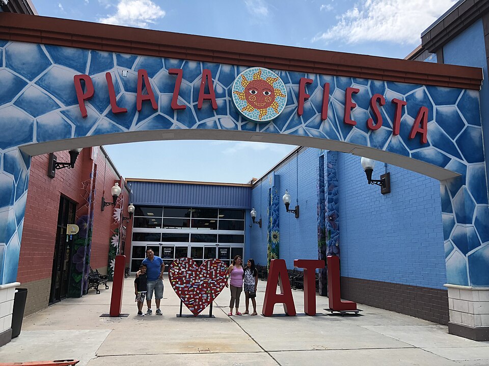 Buford Clairmont MallChamblee, GA · 2000Reinhabited · Reinhabitation: ethnic mall
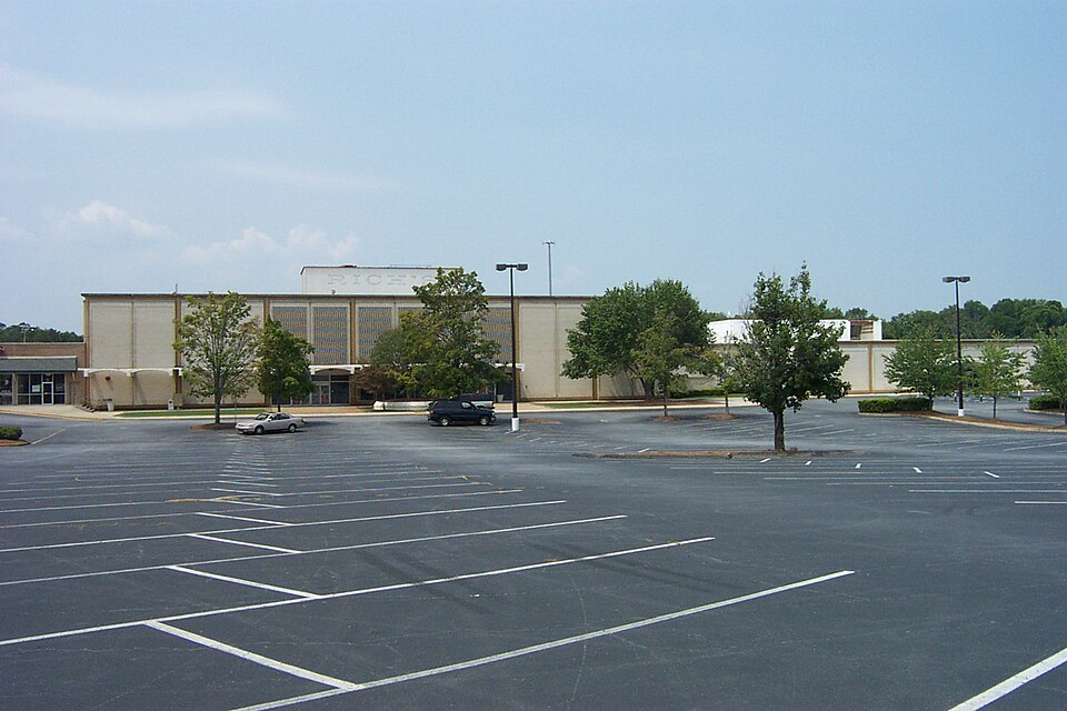 Cobb Ctr MallSmyrna, GA · 2004Partial Regreened · Partial regreening, parkColumbus Square MallColumbus, GA · 2005Redeveloped · Redevelopment: civicFurniture StoreNorcross, GAReinhabited · Reinhabitation: ethnic mallHouston MallWarner Robins, GA · 2014Reinhabited · Reinhabitation: healthcarePhipps PlazaAtlanta, GA · 2018Partial Redeveloped · Partial redevelopment, mixed use