Malls · Virginia
Cloverleaf Mall (Richmond)
Opened 1972. Closed 2008. Redeveloped in 2009.
Solid = from the authors' map · outlined = public source · dashed = model-written, not yet reviewed by a person. Tap any value's source label to see where it came from.
Site profile18 elements · what this retrofit is built with · tap a chip for the evidence
JCPenney
This site: JCPenney wikipedia · all sites with thisSears
This site: Sears wikipedia · all sites with thisOn Facebook
This site: …https://www.facebook.com/157799520921010 overture · all sites with thisWebsite alive
This site: …http://www.deadmalls.com/malls/cloverleaf_mall.html overture / http check · all sites with thisPublic body
This site: Chesterfield County county-parcels · all sites with this3+ other atlas sites within 10 km
This site: 5 within 10 km computed · all sites with this30,000+ vehicles a day on an adjacent road
This site: 88,851 on 150 fhwa-hpms · all sites with thisFast-growing county (8%+ 2018–23)
This site: 9% census-acs · all sites with thisGrocery within 800 m
This site: 3 stores openstreetmap · all sites with thisInterstate or freeway within 600 m
This site: 150 fhwa-hpms · all sites with thisOpportunity Zone
This site: 51041100210 hud-oz · all sites with thisRenter-majority tract
This site: 62% census-acs · all sites with thisTract income up 60%+ since 2013
This site: +96% census-acs · all sites with thisTract population up 25%+ since 2013
This site: +25% census-acs · all sites with thisRedeveloped
This site: Redevelopment: mixed use, new streets record · all sites with thisHousing
This site: …new_use field extraction · all sites with thisMixed use
This site: Redevelopment: mixed use, new streets extraction · all sites with thisRetail (continued)
This site: …new_use field extraction · all sites with thisFrom the authors' map
VA, Richmond: Cloverleaf Mall/Stonebridge, 2009
• Redevelopment: mixed use, new streets
Now
| Status | Retrofit builtderived from authors' map (retrofit year present) |
|---|---|
| Strategy | Redevelopedauthors' map |
| New uses | mixed, retail, housingextracted, unreviewed |
| What is there now | Redevelopment: mixed use, new streetsauthors' map |
| Retrofit year | 2009authors' map |
Deals and debt
| Date | Event | Price | Parties | Source |
|---|---|---|---|---|
| 2005 | Sold | — | Chesterfield County ← previous owner | Wikipedia |
Site context
| FEMA flood zone | X · AREA OF MINIMAL FLOOD HAZARDFEMA NFHL |
|---|---|
| EPA-regulated facilities within 500 m | 9: AURA STONEBRIDGE MULTIFAMILY; CROWN STATION VA-38; FIRESTONE COMPLETE AUTO CARE #020796; FORMER CLOVERLEAF MALL; KROGER #514-029EPA FRS |
| Census tract 51041100210 | 2,031 people, 1,557 per sq mi; median household income $79,079; median gross rent $1,618; 62% renters; 8.0% vacant units; 0.0% commute by transitACS 2023 5-year |
| Walkability (EPA, block group) | index 8.8 of 20; 26 intersections per sq mi; no transit stop within the EPA search radius; land-use mix 0.84; 77,523 jobs within 45 min by car; 1% of households without a carEPA Smart Location |
| Within a 10–15 minute walk (800 m) | 4 of 6 daily needs: 3 grocers, 0 schools, 1 parks or playgrounds, 0 health, 1 civic, 23 food and drink; 2 cycleway segments, 92 sidewalk-tagged segmentsOpenStreetMap |
| Opportunity Zone | yes, tract 51041100210 (rural)HUD |
| Housing permits, Chesterfield County (VA), 2024 | 462 units in 5+ unit buildings, 0 in 2–4, 1,845 single-family; 2023: 1,456 in 5+Census BPS |
| Social vulnerability (CDC SVI 2022, tract) | overall percentile 0.65; socioeconomic 0.70; housing and transport 0.49; 14% below 150% of poverty; 0% of households with no vehicleCDC/ATSDR |
| Other atlas sites nearby | 5 within 10 km, 9 within 25 km: Chesterfield Towne Center (7.3 km); Sauer Center (9.3 km); Main Street Station mall (9.5 km); Willow Lawn Shopping Center (9.6 km); Tobacco Row (9.7 km)computed |
| Overture Maps | place Cloverleaf Mall (shopping_mall, confidence 0.77, from Overture, meta); building footprint 11,676 m², 6.428852558135986 mOverture (CDLA-Permissive 2.0) |
| Website and social | www.deadmalls.com (alive); archived 2001–2026 (Wayback) · social: facebookOverture / Internet Archive |
| Attention: Wikipedia page views | 11,103 since 2015; 3,047 in the last 12 months (+33% vs the prior 12); peak 2025-12 with 444Wikimedia |
| Tract change 2013–2023 | population +25% (1,623 → 2,031); median income +96% ($40,395 → $79,079); renters 46% → 62%; median home value +28% ($162,700 → $208,800)Census ACS 5-year |
| Natural hazard risk (FEMA National Risk Index, tract) | very low overall (score 2.7); expected annual loss $379,432; community resilience relatively moderateFEMA NRI |
| Tax-credit housing within 1 km | noneHUD LIHTC |
| Retail trade in the county, 2012 to 2023 | 933 establishments (-1%); 22,577 jobs (+33%)Census CBP |
| Housing market in the county | typical home value $410,086 (+3% 1 yr, +26% 5 yr); typical rent $1,839/mo (+3% 1 yr), 2026-09Zillow Research |
| Traffic on the busiest road within 600 m (2024) | 88,851 vehicles a day on 150 (freeway or expressway, 6 lanes); 1,792 trucks; 24 counted segmentsFHWA HPMS |
Similar sites
- Coliseum Mall, Hampton, VA · Malls · similar GLA (991,000 sq ft); opened 1973; same strategy: redevelop
- Los Arcos Mall, Scottsdale, AZ · Malls · similar GLA (607,350 sq ft); opened 1969; same strategy: redevelop
- Bannister Mall, Kansas City, MO · Malls · similar GLA (1,014,390 sq ft); closed 2007; same strategy: redevelop
- Century Plaza, Birmingham, AL · Malls · similar GLA (740,000 sq ft); opened 1975; closed 2009
Elsewhere on the web
Pages with photos
- Cloverleaf Mall ar.inspiredpencil.com
- Cloverleaf Mall - 1970s vintagerva.blogspot.com
- Abandoned Mall Interior labelscar.com
- Mallmanac.com: Cloverleaf Mall, Richmond, VA mallmanac.com
- 27 archive photos of Cloverleaf Mall in Chesterfield, VA richmond.com
- Cloverleaf Mall fity.club
- Cloverleaf Mall, Richmond, VA mallmanac.blogspot.com
- Sears/Cloverleaf Mall flickr.com

Search images: Google · Bing · Commons · references: ULI case studies · Google Scholar
Multifamily screen
- retrofit already built
- 800,000 sq ft GLA (large site)
- county grew 9.5% 2018–23
- median rent $1,542
- housing in the record
- public owner
Inputs: record fields (size, status) and county Census ACS 2018–2023 figures (growth, rent). How the points work. Not a recommendation.
History and original facts
| Now called / also known as | Stonebridge |
|---|---|
| Opened | 1972Esri 2014 layer |
| Closed | 2008extracted, unreviewed |
| Gross leasable area | 800,000 sq ftEsri 2014 layer |
| Stores at peak | 45Esri 2014 layer |
| Anchors | Vacant, JCPenney, Sears, Thalhimers |
| Address | Midlothian Tpke. & Rt. 150 |
| County | Chesterfield |
| Census division | 5 · South Atlantic |
Not yet recorded: acres, original developer. Know it? Tell us.
Background
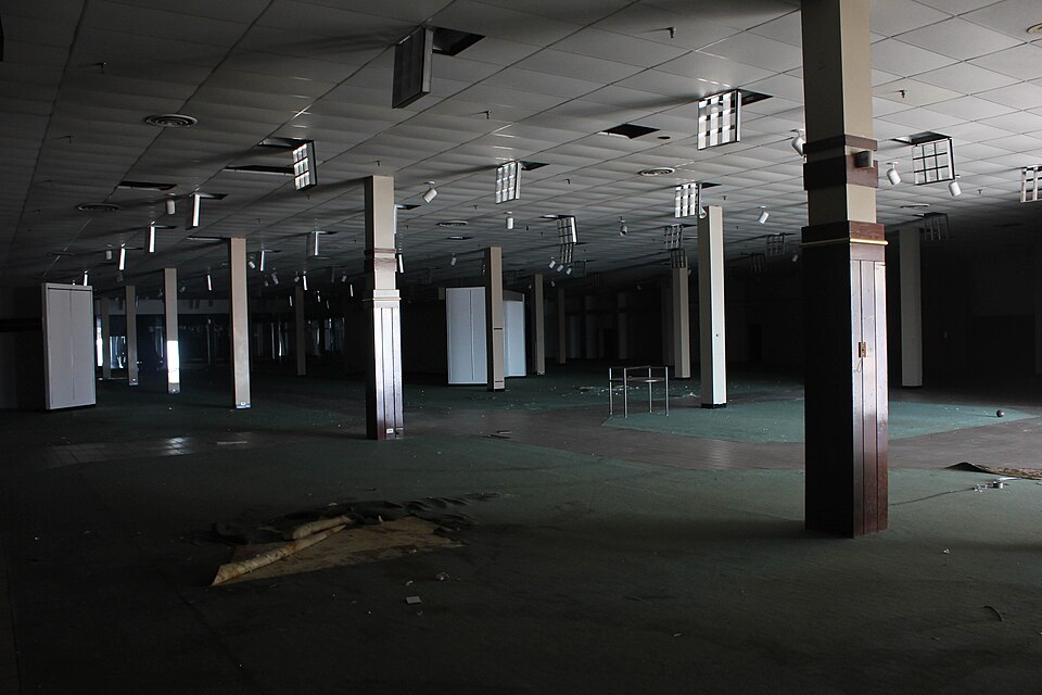
Stonebridge Shopping Center, formerly Cloverleaf Mall, was a shopping mall located in Chesterfield County, Virginia on U.S. Route 60 just west of State Route 150. The mall opened in 1972 and featured two anchor stores, JCPenney, and Sears. A third anchor, Thalhimers, opened a year later.
Excerpt from Wikipedia (authors and history), CC BY-SA 4.0. May be older than the record above.
Timeline
- 1972 Opened
- 1973 anchor added
- 2000 anchor closed
- 2001 anchor closed
- 2003 anchor closed
- 2008 closed
- 2009 Retrofit: redevelop
- 2011 demolished
Sources
- Wikipedia: Cloverleaf Mall · supports: year closed
8 quoted sentences
Cloverleaf Mall permanently closed in 2008.
The mall opened in 1972 and featured two anchors: J. C. Penney and Sears.
Thalhimers was added a year later as a third anchor.
JCPenney closed their Cloverleaf store and moved to Chesterfield Towne Center.
- Esri StoryMaps: Closed_US_Malls feature layer (2014) · 2014-10-02
- Retrofitting Suburbia Interactive Mall Map (ArcGIS web map ce33ab26…) · 2021-01-20
More in Virginia
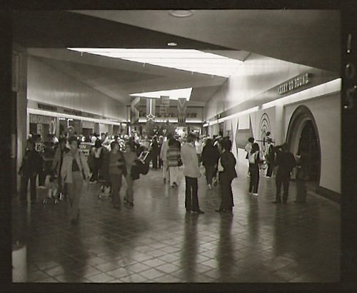 Coliseum MallHampton, VA · 2010Redeveloped · Redevelopment: mixed useNewmarket North MallHampton, VA · 2000Reinhabited · Reinhabitation: office
 Tysons Corner CenterTysons Corner, VA · 2016Partial Redeveloped · Partial redevelopment: residential
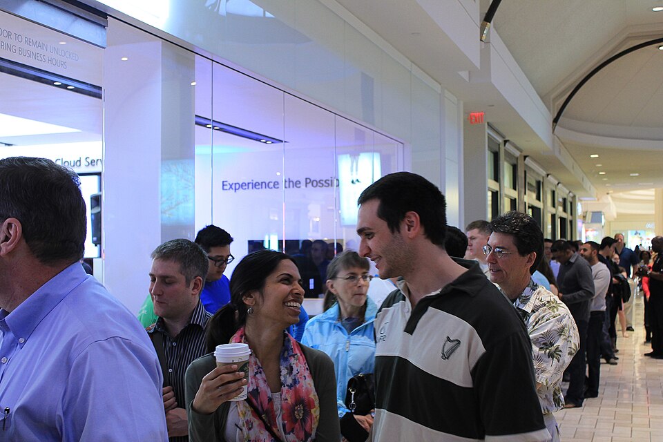 Tysons GalleriaTysons Corner, VA · 2016Partial Redeveloped · Partial redevelopment: office10690 Parkridge BoulevardReston, VARedevelopment, proposed