Other · Colorado
Central Park
4700-acre former airport now a mixed-use neighborhood with 14k+ residents, 50 parks, and $1.8B in housing permits (2023-2024). · summary, model-written
Solid = from the authors' map · outlined = public source · dashed = model-written, not yet reviewed by a person. Tap any value's source label to see where it came from. documented = a quoted excerpt (click to read it) · reported = a source named, no excerpt yet · no source.
Site profile15 elements · what this retrofit is built with · tap a chip for the evidence
3+ other atlas sites within 10 km
This site: 16 within 10 km computed · all sites with this30,000+ vehicles a day on an adjacent road
This site: 31,000 on U.S. 40 fhwa-hpms · all sites with thisCounty permitting 2,000+ apartment units a year
This site: 3,118 units, Denver County census-bps · all sites with this60+ acre site
This site: 4700 acres newtypes-extraction · all sites with thisRedeveloped
This site: A large residential neighborhood with schools, parks, pools, shopping/business districts, recreation center, library, commuter rail station, office space,… record · all sites with thisRegreened
This site: A large residential neighborhood with schools, parks, pools, shopping/business districts, recreation center, library, commuter rail station, office space,… record · all sites with thisCivic and government
This site: …rks, pools, shopping/business districts, recreation center, library, commuter rail station, office space, retail space, and var newtypes-extraction · all sites with thisEducation
This site: …new_use field newtypes-extraction · all sites with thisEntertainment and sports
This site: …new_use field newtypes-extraction · all sites with thisHousing
This site: A large residential neighborhood with schools, parks, pools, shopping/business newtypes-extraction · all sites with thisLogistics and industrial
This site: …new_use field newtypes-extraction · all sites with thisMixed use
This site: …new_use field newtypes-extraction · all sites with thisOffice
This site: …stricts, recreation center, library, commuter rail station, office space, retail space, and various housing types. Approved by newtypes-extraction · all sites with thisPark and open space
This site: …new_use field newtypes-extraction · all sites with thisRetail (continued)
This site: large residential neighborhood with schools, parks, pools, shopping/business districts, recreation center, library, commuter ra newtypes-extraction · all sites with thisNow
| Status | Retrofit builtWikipedia no source |
|---|---|
| Strategy | Redeveloped · RegreenedWikipedia no source |
| New uses | civic, education, entertainment, housing, logistics, mixed, office, park, retailWikipedia no source |
| What is there now | A large residential neighborhood with schools, parks, pools, shopping/business districts, recreation center, library, commuter rail station, office space, retail space, and various housing types.newtypes-extraction reported |
| Retrofit year | 2001newtypes-extraction reported |
| Redeveloper | Forest City Enterprises/Brookfieldnewtypes-extraction reported |
Planning
| Entitlement year | 1995Wikipedia no source |
|---|---|
| Planning notes | Approved by Stapleton Development Foundation.Wikipedia no source |
Site context
| Housing permits, Denver County (CO), 2024 | 3,118 units in 5+ unit buildings, 4 in 2–4, 872 single-family; 2023: 4,549 in 5+Census BPS |
|---|---|
| Other atlas sites nearby | 16 within 10 km, 27 within 25 km: Celebrity Sports Center (0.0 km); Former Park Hill Golf Club (0.0 km); Former K-Mart site (0.0 km); Union Station North (2.5 km); Kmart in the Broadway Marketplace (3.2 km)computed |
| Retail trade in the county, 2025 (BLS QCEW) | 30,425 jobs in 2,329 establishments; average annual pay $52,368; employment location quotient 0.55; employment -5.4% on the yearBLS QCEW 2025, NAICS 44-45, private |
| Jobs located in the tract, 2022 | 6,060 jobs; 49 in retail trade, 216 in accommodation and food (workplace blocks summed to tract 08031002704)Census LEHD LODES8 WAC 2022 |
| Upward mobility (Opportunity Atlas, 2010 tract) | children of low-income (25th percentile) families reached the 39th income percentile as adults; 4.2% incarcerated at the 2010 count (115 children in the sample); born 1978–83, measured 2014–15Opportunity Insights |
| Food access (USDA FARA 2019, 2010 tract) | not a low-access tract at 1 mile; poverty rate 16.4%; 191 SNAP householdsUSDA ERS |
| Schools | Denver County School District 1 (PK-12); 14 public schools within 1 mile: Emily Griffith High School; Contemporary Learning Academy; Dora Moore ECE-8 School; Morey Middle SchoolNCES EDGE |
| Elevation | 5,276 ft above sea level at the site pointUSGS 3DEP |
| Storm events in the county, 2016-2025 | 183 county-logged events: 127 hail, 41 thunderstorm wind, 7 flash flood, 3 heavy rain; $820,000 property damage reported; forecast-zone events (most flood, winter and heat) not countedNOAA Storm Events |
| Homes for sale in ZIP 80203, 2026-09 | median list price $339,225 (-5.1% on the year); 139 active listings; median 83 days on market; 32% with a price cutRealtor.com Research |
| Retail trade in the county, 2012 to 2023 | 2,348 establishments (+3%); 32,628 jobs (+24%)Census CBP |
| Housing market in the county | typical home value $528,188 (-2% 1 yr, -1% 5 yr); typical rent $1,867/mo (+0% 1 yr), 2026-09Zillow Research |
| Traffic on the busiest road within 600 m (2024) | 31,000 vehicles a day on U.S. 40 (principal arterial, 6 lanes); 990 trucks; 39 counted segmentsFHWA HPMS |
Summary, model-written
Former Stapleton International Airport (closed 1995) redeveloped as Central Park neighborhood starting 2001. Built status confirmed. 4700-acre site now includes housing (14,000+ residents by 2011), retail, offices, parks, schools, and transit (RTD A-Line, 2016).
Why. 4700 acres, median rent $1,770, mixed-use development (housing, retail, office, parks) completed. Peer comparison shows Stapleton Airport (same site) as top match (11/11 score).
Where it stands. Fully built neighborhood with 3,200+ housing units (2008), 50 parks, and 2023 retail employment growth (24.1%).
For a planner
- 4700 acres is largest residential neighborhood in Denver
- 12 sub-neighborhoods, 11 schools, 50 parks documented
- RTD A-Line connects to downtown/DIA (2016)
For a developer
- Median rent $1,770 (2026 data)
- 2023-2024 permits: $1.8B in housing value
- Retail employment grew 24.1% (2012-2023)
What we do not know yet
- 'Regreen' strategy not detailed
- Logistics use not quantified
- No current vacancy rates provided
Generated by qwen3-30b-a3b-64k:latest on Dell 5820 RTX 3090 (Ollama, qwen3-30b-a3b) from the fields, parcels, deals and context layers on this page, with no outside knowledge. It is regenerated when the record changes and has not been checked by a person. How it is made.
Similar sites
- Stapleton International Airport, Denver, CO · Other · similar size (4700 acres); closed 1995; same strategy: redevelop
- Cinderella Mall, Englewood, CO · Malls · closed 1997; same strategy: redevelop, regreen; also in CO
- Naval Air Station Barbers Point, Kalaeloa, HI · Other · similar size (3700 acres); closed 1999; same strategy: redevelop, regreen
- Villa Italia Mall, Lakewood, CO · Malls · same strategy: redevelop, regreen; also in CO; 9 km away
Elsewhere on the web
Search images: Google · Bing · Commons · references: ULI case studies · Google Scholar
Multifamily screen
- retrofit already built
- 4700 acres
- median rent $1,770
- housing in the record
Inputs: record fields (size, status) and county Census ACS 2018–2023 figures (growth, rent). How the points work. Not a recommendation.
History and original facts
| Closed | 1995newtypes-extraction |
|---|---|
| Acres | 4,700newtypes-extraction reported |
| County | Denver County |
| Census division | 8 · Mountain |
| Notes | Draft from Wikipedia, model-extracted, unreviewed: The former Stapleton International Airport was redeveloped into the Central Park neighborhood, a new urbanist project with housing, retail, office, parks, and civic uses. |
Not yet recorded: GLA, year opened, original developer. Know it? Tell us.
Background
Central Park, previously Stapleton, is a neighborhood within the city limits of Denver and Aurora, Colorado. Located east of downtown Denver, the neighborhood is at the former site of the decommissioned Stapleton International Airport, which closed in 1995. It is the largest residential neighborhood within the city of Denver. The Central Park neighborhood contains twelve specifically named sub-neighborhoods, 11 public/private schools, 50 parks (including city regional and community pocket-parks), 7 pools, several shopping and business districts, a city of Denver recreation center, and a Denver library.
Excerpt from Wikipedia (authors and history), CC BY-SA 4.0. May be older than the record above.
Timeline
- 1990 Stapleton Development Foundation convened
- 1995 Master plan produced for the site
- 1995 Stapleton International Airport closed
- 1995 Closed
- 2001 Construction began
- 2001 Retrofit: redevelop, regreen
- 2004 Residents moved into first apartments
- 2006 Population grew above 5,000; Denver School of Science and Technology and The Shops at Northfield opened
- 2007 80-acre 'Central Park' opened
- 2008 3,200 housing units built
- 2011 Population over 14,000; trail network reached 38 miles
- 2016 RTD A-Line connected neighborhood to downtown and DIA
Sources
- Central Park, Denver · CC BY-SA 4.0
11 quoted sentences
Central Park, previously Stapleton
A private group of Denver civic leaders, the Stapleton Development Foundation, convened in 1990
produced a master plan for the site in 1995
Stapleton International Airport, which closed in 1995.
More in Colorado
 Cinderella MallEnglewood, CO · 2020Redeveloped · Regreened · Redevelopment: transit-oriented mixed use Partial regreening: park
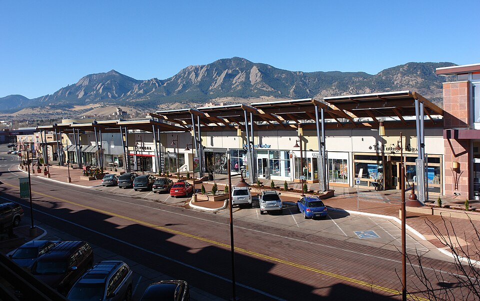 Crossroads MallBoulder, CO · 2007Redeveloped · Redevelopment: retail, office and restored street grid
 Foothills MallFort Collins, CO · 2013Partial Redeveloped · Partial redevelopment, public space
 Lamar Plaza StationLakewood, CO · 2016Partial Regreened · Partial regreening, green islands