Malls · Ohio
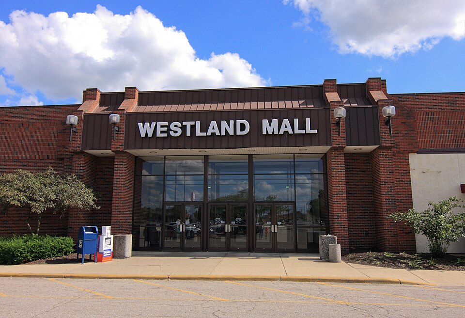
Westland Mall (Columbus)
Opened 1969. Closed 2017. Redeveloped in 2023.
Solid = from the authors' map · outlined = public source · dashed = model-written, not yet reviewed by a person. Tap any value's source label to see where it came from. documented = a quoted excerpt (click to read it) · reported = a source named, no excerpt yet · no source.
Site profile17 elements · what this retrofit is built with · tap a chip for the evidence
Lazarus
This site: Lazarus wikipedia · all sites with thisSears
This site: Sears wikipedia · all sites with thisWoolworth
This site: Woolworth wikipedia · all sites with thisOn Facebook
This site: …https://www.facebook.com/136393592892638 overture · all sites with this3+ other atlas sites within 10 km
This site: 3 within 10 km computed · all sites with this30,000+ vehicles a day on an adjacent road
This site: 101,928 on IR 270 N fhwa-hpms · all sites with thisCounty permitting 2,000+ apartment units a year
This site: 5,940 units, Franklin County census-bps · all sites with thisHigh social vulnerability tract (SVI ≥ 0.75)
This site: 0.98 cdc-svi · all sites with thisInterstate or freeway within 600 m
This site: IR 270 N fhwa-hpms · all sites with thisLower-income tract (< $50k)
This site: $35,272 census-acs · all sites with thisOpportunity Zone
This site: 39049008230 hud-oz · all sites with thisRenter-majority tract
This site: 100% census-acs · all sites with thisTract population up 25%+ since 2013
This site: +92% census-acs · all sites with thisWalkable block group (EPA ≥ 12)
This site: …index 15.8 epa-walkability · all sites with this1M+ sq ft GLA
This site: 1,042,610 sq ft esri-closed-us-malls-2014 · all sites with thisRedeveloped
This site: The Sears Auto Center, NTB, and JCPenney structures were left standing as part of LGR's redevelopment plans. extraction · all sites with thisMixed use
This site: …new_use field extraction · all sites with thisNow
| Status | Demolishedextracted, unreviewed |
|---|---|
| Strategy | Redevelopedextracted, unreviewed documentedOn April 26, 2019, plans were announced to redevelop the Westland Mall site by LGR Weston of Columbus, which will become Weston Town Centre, a mixed-use development complement to the casino across the street. |
| New uses | mixedextracted, unreviewed reported |
| What is there now | The Sears Auto Center, NTB, and JCPenney structures were left standing as part of LGR's redevelopment plans.extracted, unreviewed documentedThe Sears Auto Center, NTB, and JCPenney structures were left standing as part of LGR's redevelopment plans. |
| Retrofit year | 2023extracted, unreviewed reported |
| Redeveloper | LGR Westonextracted, unreviewed reported |
Planning
| Public purchase or subsidy | yesextracted, unreviewed documentedIn February 3, 2023, Ohio Governor Mike DeWine announced $20,000,000+ for the revitalization of the area. |
|---|---|
| Entitlement year | 2023extracted, unreviewed reported |
Securitised debt and public filers
Filings (2001 to date) that name “Westland Mall” and “Columbus” (45 hits, first 45 sampled, 9 other filers such as tenants left out). No commercial-mortgage trust names this mall in the sample, which does not rule out a securitised loan. Text matches, not a title search. Open the search · all trusts.
| Kind | Filer | Filings | Dates | Forms |
|---|---|---|---|---|
| Public owner (weak) | MILLS LIMITED PARTNERSHIP | 6 | 2004-11-09 to 2005-11-09 | 8-K 5, 10-K 1 |
| Public owner (weak) | MILLS CORP | 6 | 2004-11-09 to 2005-11-09 | 8-K 5, 10-K 1 |
| Public owner (weak) | Seritage Growth Properties (SRG, SRG-PA) | 4 | 2019-11-01 to 2020-03-02 | 8-K 2, 10-Q 1, 10-K 1 |
| Public owner (weak) | SIMON PROPERTY GROUP INC /DE/ (SPG, SPG-PJ) | 3 | 2007-04-27 to 2007-10-29 | 8-K 3 |
| Public owner (weak) | ROUSE COMPANY | 1 | 2003-08-14 to 2003-08-14 | 10-Q 1 |
Site context
| FEMA flood zone | no NFHL polygon at point (unmapped or outside coverage)FEMA NFHL |
|---|---|
| EPA-regulated facilities within 500 m | 7: DUTCH GIRL CLEANERS; FIRESTONE; FORMER DELPHI AUTOMOTIVE FACILITY; FRUEHAUF CORP; LINCOLN VILLAGE POST OFFICEEPA FRS |
| Census tract 39049008230 | 3,422 people, 7,930 per sq mi; median household income $35,272; median gross rent $1,400; 100% renters; 9.2% vacant units; 1.8% commute by transitACS 2023 5-year |
| Walkability (EPA, block group) | index 15.8 of 20; 166 intersections per sq mi; nearest transit stop 418 m; land-use mix 0.73; 118,778 jobs within 45 min by car, 74,331 by transit; 10% of households without a carEPA Smart Location |
| Opportunity Zone | yes, tract 39049008230 (rural)HUD |
| Housing permits, Franklin County (OH), 2024 | 5,940 units in 5+ unit buildings, 169 in 2–4, 2,013 single-family; 2023: 5,113 in 5+Census BPS |
| Social vulnerability (CDC SVI 2022, tract) | overall percentile 0.98; socioeconomic 0.97; housing and transport 0.97; 74% below 150% of poverty; 8% of households with no vehicleCDC/ATSDR |
| Other atlas sites nearby | 3 within 10 km, 10 within 25 km: National Church Residences Corporate Campus (8.0 km); Northland (9.9 km); City Center (10.0 km)computed |
| Overture Maps | place Westland Mall - Columbus, OH (historic_site, confidence 0.91, from Overture, meta); building footprint 7,801 m², 2.448162078857422 mOverture (CDLA-Permissive 2.0) |
| Website and social | no website listed · social: facebookOverture / Internet Archive |
| Attention: Wikipedia page views | 23,541 since 2015; 4,175 in the last 12 months (-23% vs the prior 12); peak 2023-09 with 1,527Wikimedia |
| Tract change 2013–2023 | population +92% (1,782 → 3,422); median income +12% ($31,366 → $35,272); renters 100% → 100%; median home value n/aCensus ACS 5-year |
| Natural hazard risk (FEMA National Risk Index, tract) | very low overall (score 11.0); expected annual loss $340,804; high: cold wave; community resilience relatively moderateFEMA NRI |
| Tax-credit housing within 1 km | noneHUD LIHTC |
| Retail trade in the county, 2025 (BLS QCEW) | 67,133 jobs in 3,800 establishments; average annual pay $45,092; employment location quotient 0.86; employment -0.1% on the yearBLS QCEW 2025, NAICS 44-45, private |
| Jobs located in the tract, 2022 | 754 jobs; 127 in retail trade, 47 in accommodation and food (workplace blocks summed to tract 39049008230)Census LEHD LODES8 WAC 2022 |
| Upward mobility (Opportunity Atlas, 2010 tract) | children of low-income (25th percentile) families reached the 32th income percentile as adults; 3.1% incarcerated at the 2010 count (912 children in the sample); born 1978–83, measured 2014–15Opportunity Insights |
| Food access (USDA FARA 2019, 2010 tract) | not a low-access tract at 1 mile; poverty rate 41.0%; median family income $30,742; 250 SNAP householdsUSDA ERS |
| Schools | South-Western City School District (PK-12); 3 public schools within 1 mile: Bridge Gate Community School; Stiles Elementary School; Stiles Family CenterNCES EDGE |
| Elevation | 884 ft above sea level at the site pointUSGS 3DEP |
| Storm events in the county, 2016-2025 | 330 county-logged events: 159 thunderstorm wind, 83 hail, 51 flood, 26 flash flood; $2,543,050 property damage reported; 2 direct deaths; forecast-zone events (most flood, winter and heat) not countedNOAA Storm Events |
| Homes for sale in ZIP 43228, 2026-09 | median list price $260,000 (-3.5% on the year); 81 active listings; median 41 days on market; 27% with a price cutRealtor.com Research |
| Retail trade in the county, 2012 to 2023 | 3,600 establishments (-1%); 65,828 jobs (+2%)Census CBP |
| Housing market in the county | typical home value $292,001 (+0% 1 yr, +23% 5 yr); typical rent $1,511/mo (+3% 1 yr), 2026-09Zillow Research |
| Traffic on the busiest road within 600 m (2024) | 101,928 vehicles a day on IR 270 N (Interstate, 6 lanes); 15,493 trucks; 32 counted segmentsFHWA HPMS |
Summary, model-written
Westland Mall opened in 1969 developed by the Richard E. Jacobs Group and operated as a regional shopping center until the majority of the mall closed in 2012, with the last anchor shutting in 2017. In 2019 the Sears portion was sold to LGR Weston, and demolition began in 2023 as part of a planned mixed-use redevelopment that retains the Sears Auto Center, NTB, and JCPenney structures.
Why. Anchor store losses—including Macy's closure in 2007 and the final anchor closing in 2017—undermined the mall’s viability, leading to its closure and subsequent demolition for redevelopment. The record does not cite debt or competition as explicit causes.
Where it stands. The site is demolished and under the control of LGR Weston, which acquired the Sears portion in 2019 and initiated demolition in 2023 for a mixed-use project.
For a planner
- Public subsidy was used to support the redevelopment.
- Entitlement for mixed-use redevelopment was granted in 2023.
- Precedent of preserving existing structures (Sears Auto Center, NTB, JCPenney) within the new plan.
- Open question: how will the retained structures be integrated into the mixed-use layout and what are the phasing details?
For a developer
- Site size: approximately 1,042,610 sq ft of GLA.
- Controlled by LGR Weston with entitlement secured in 2023.
- No flood, transit, or environmental constraints are noted in the record.
- Market signals show county population growth of 3.6% (2018‑2023) and housing demand supporting the mixed-use plan.
What we do not know yet
- Data verification status is 'draft', indicating thin data quality.
- Floodplain, transit access, and environmental conditions are not specified.
- Amount and terms of the public subsidy are unknown.
- Phasing, timeline, and detailed program for the mixed-use build‑out are not provided.
- Condition and specific reuse plans for the retained Sears Auto Center, NTB, and JCPenney structures are unclear.
Generated by nvidia/nemotron-3-super-120b-a12b on NVIDIA API via Hermes CT from the fields, parcels, deals and context layers on this page, with no outside knowledge. It is regenerated when the record changes and has not been checked by a person. How it is made.
Similar sites
- Landmark Mall, Alexandria, VA · Malls · similar GLA (880,000 sq ft); opened 1965; closed 2017
- Lincoln Mall, Matteson, IL · Malls · similar GLA (990,000 sq ft); opened 1973; closed 2015
- Northwest Mall, Houston, TX · Malls · similar GLA (794,144 sq ft); opened 1968; closed 2017
- Highland Mall, Austin, TX · Malls · similar GLA (1,116,000 sq ft); opened 1971; closed 2015
Elsewhere on the web
Retail history: Westland Mall on DeadMalls.com photos, field notes and visitor memories since 2000; matched by name and city; nothing copied here
Pages with photos
- Westland Mall Columbus, OH March 2017 (33612313596) commons.wikimedia.org
- Westland Mall labelscar.com
- Westland Mall Columbus Ohio fity.club
- Westland Mall - Abandoned abandonedonline.net
- The Abandoned Westland Mall | Columbus, OH | The infamous, n… flickr.com
- Westland Mall – Columbus, Ohio – Mateo de Colón mateodecolon.com
- Inside Westland Mall, Columbus, OH: The Rise, Fall, And What's Next ... bestattractions.org
- State to help tear down Westland Mall, other buildings across Ohio ... bizjournals.com


Search images: Google · Bing · Commons · references: ULI case studies · Google Scholar
Multifamily screen
- retrofit already built
- closed or demolished site (sourced)
- already in play: under construction, approved, or sold to a developer with housing plans
- 1,042,610 sq ft GLA (large site)
- county grew 3.6% 2018–23
- housing in the record
Inputs: record fields (size, status) and county Census ACS 2018–2023 figures (growth, rent). How the points work. Not a recommendation.
History and original facts
| Opened | 1969Esri 2014 layer |
|---|---|
| Closed | 2017extracted, unreviewed documentedIn November 2012, the majority of the mall closed, and the last anchor closed in 2017. |
| Gross leasable area | 1,042,610 sq ftEsri 2014 layer reported |
| Stores at peak | 77Esri 2014 layer reported |
| Original developer | Richard E. Jacobs Groupextracted, unreviewed documentedAll but Southland were constructed and originally operated by the Richard E. Jacobs Group, and featured the same mix of anchor stores. |
| Anchors | Sears, Woolworth, Lazarus, Penney's |
| Address | I-270 & West Broad Street |
| County | Franklin |
| Census division | 3 · East North Central |
| Notes | Wikipedia categories: Demolished shopping malls in the United States |
Not yet recorded: acres. Know it? Tell us.
Background
Westland Mall was a 860,000-square-foot (80,000 m2) shopping center located at the intersection of U.S. Route 40 and Interstate 270 on the west side of Columbus, Ohio. In November 2012, the majority of the mall closed, and the last anchor closed in 2017. A mixed use development is planned, and demolition began around August 2023.
Excerpt from Wikipedia (authors and history), CC BY-SA 4.0. May be older than the record above.
Timeline
- 1969 Opened
- 1969 Westland Mall opened
- 1982 Westland enclosed and north entryway added
- 1987 Upper floor of Sears converted to office for Discover
- 1994 Woolworth closed
- 2003 Kashani bought the mall
- 2007 Macy's closed
- 2012 Majority of mall closed
- 2017 Last anchor closed
- 2019 Sears portion sold to LGR Weston
- 2023 Demolition began
Sources
- Wikipedia: Westland Mall (Ohio) · supports: after notes, original developer, public subsidy, status, strategy, year closed
16 quoted sentences
In November 2012, the majority of the mall closed, and the last anchor closed in 2017.
All but Southland were constructed and originally operated by the Richard E. Jacobs Group, and featured the same mix of anchor stores.
The Sears Auto Center, NTB, and JCPenney structures were left standing as part of LGR's redevelopment plans.
The Sears building was demolished in May 2024.
- Esri StoryMaps: Closed_US_Malls feature layer (2014) · 2014-10-02